
There are a couple of useful carp fishing tools on the internet that are really useful to help you do a bit of home work on your chosen French carp lake before you arrive.
These range from measuring casting distances on google maps to figuring out how much the tolls will be for your journey, find them here…
1. Detailed Aerial Views
Google Earth probably doesn’t need any introduction, as it is run by one of the biggest in the web business. This gives you an aerial view with more detailed resolution. There is also whole host of other information to be had from this site, including route planning, local amenities etc.
When you book a French carp fishing holiday with us, you are provided with the co-ordinates for your venue in your ‘info pack’ (found in your customer area). You can use these to locate your lake on the map.
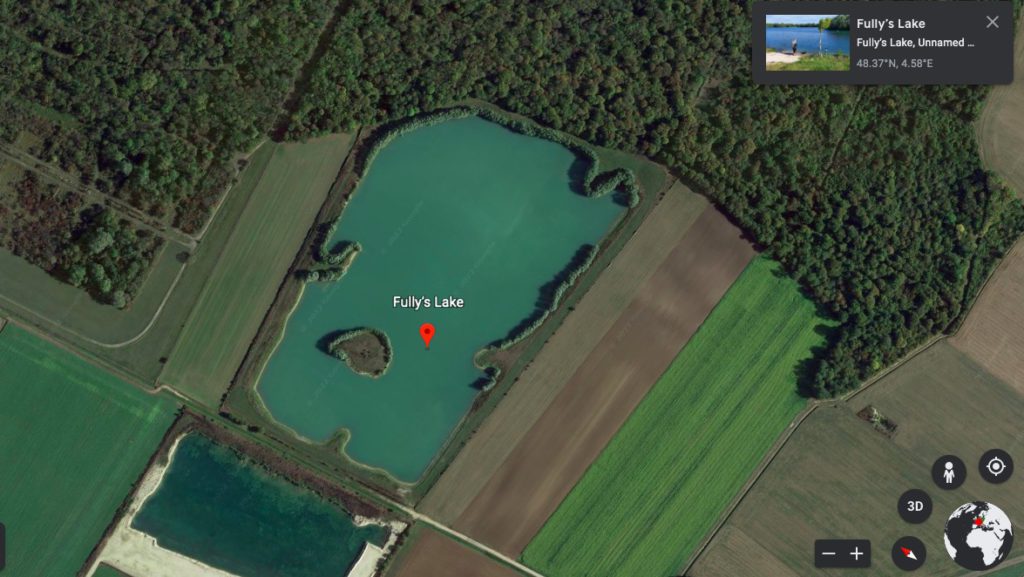
For example take a look at one of our venues, Fullys Lake.
I’d also recommend that anyone going to France checks out their chosen venue prior to going and gets coordinates of the local supermarket for example, just to make things that much smoother!
The aerial maps can give you a good idea of the general layout of the lake, the shape, size and orientation. You can find where north is so on arrival if you have checked the prevailing winds you can take a more educated guess as to where the carp may be.
2. Measure Distance or Area on a Map
This one in our opinion is the most underused but useful website on this list. You can measure distances on the map, making finding casting distances to hot spots such as islands easy!
Free Map Tools – Measure Distance is the website we recommend. Again, just input the lake’s co-ordinates.

Some of our French carp lakes, like Lepinet and Jonchery, require you to book your swims in advance. This tool makes it easier to choose. Perhaps you fancy a particular swim but want to know realistically how long it’ll take you to walk to the facilities for example. Or you want to know how close you’ll be to your mates.
We utilise these features to get an accurate size of every lake and to provide you with as much detail as possible for our carp fishing venues. So what you expect is exactly what you get!
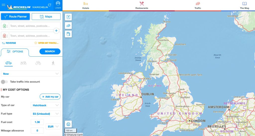
3. Calculating Tolls and Fuel Costs
We use ViaMichelin to calculate more accurate journey costs. You can put in the start point and destination and add your vehicle type for an idea of the tolls and fuel costs for your journey. Ideal when you’re organising realistic holiday costs between a bigger group.
4. A Carp Fishing Equipment List
There’s nothing worse than forgetting an essential bit of kit and only realising once you’re on the bank in France. So what is the solution for all you scatterbrains out there? Simple, write out check lists! Here is ours – Carp Fishing Tackle Checklist
Then there’s only one thing left to do… enjoy your carp fishing holiday!

Gareth,
Yes, http://www.geoportail.fr is an excellent site and I would say for France, forget Google Earth and just use this – the clarity of the aerial shots is truly excellent – on our lake you can see the lily pads !
Geoportail is very interresting, i will suggest you another site of pictures witch you can fin a lot of real sideway pictures of big towns and small villages of France : http://www.leuropevueduciel.com
Thought I new about most of the tools used to locate ‘off road routes’ to the edge of lakes. The Geo Portal is going to be usefull for future carp fishing research.